About the famous Green Tara at the Cleveland Museum
- click on the image to enlarge | click on the image again to enlarge further
click Esc or X to close and return to this page
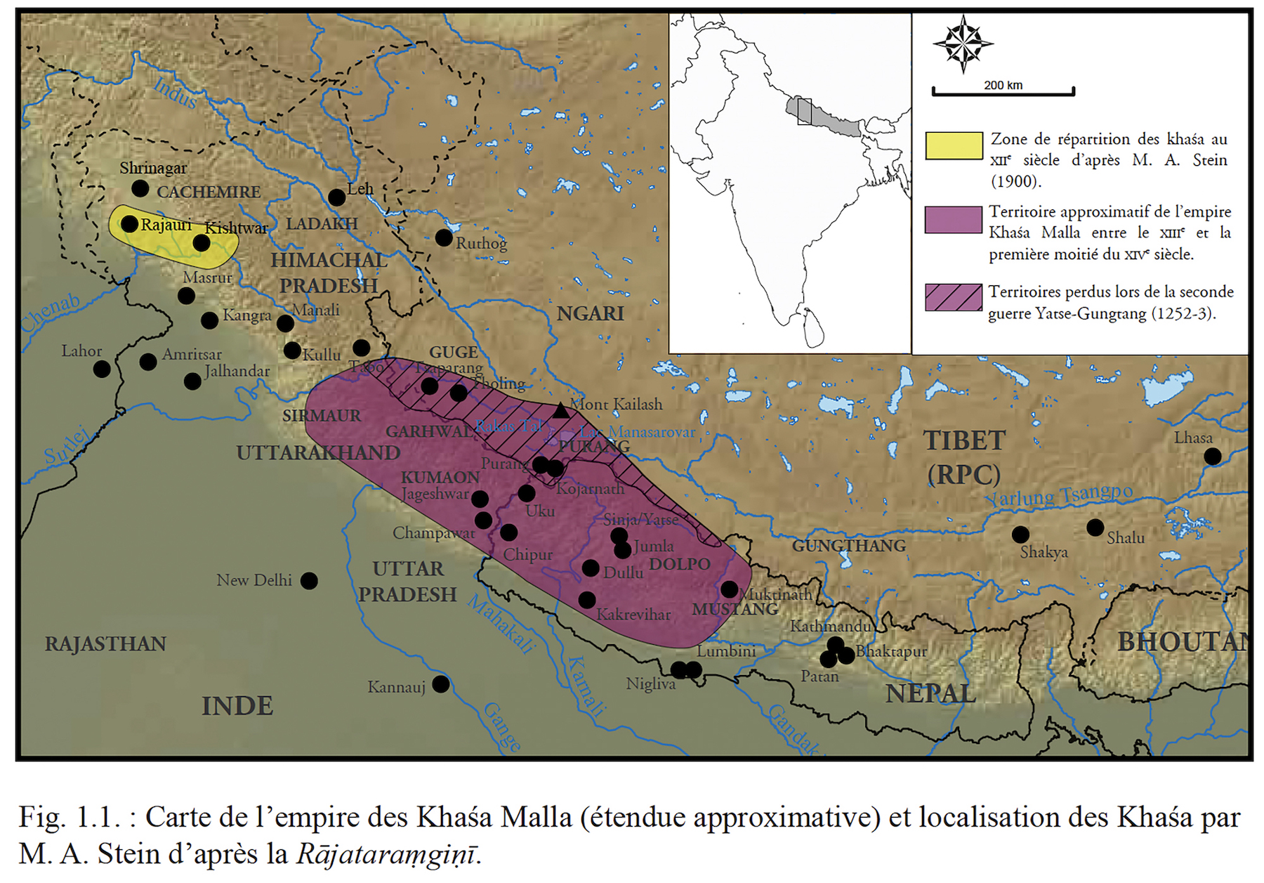
Figure 59: Map showing the expanse of the Khasa Yatse kingdom. The legend is in French, but the empire corresponds to the purple area. The striped, purple area corresponds to the part lost during the second war against Gungthang in 1252-1253.
Picture : After David Andolfatto. « Le Pays aux Cent-Vingt-Cinq-Mille Montagnes. Étude Archéologique du Bassin de la Karnali (Népal) entre le XIIe et le XVIe siècle » . Sciences de l’Homme et Société. Université Paris 4 Paris-Sorbonne, 2019. Fig.1.1